Floodplains: A natural flood defence

Floodplains: A natural flood defence

Following heavy rain across Wiltshire & Swindon, floodplains have provided essential protection against floods in our towns and cities.

Areas across Wiltshire & Swindon experienced a lot of flooding following heavy rain last week, with some homes impacted by flooding and many roads closed as they became unpassable. Areas which were particularly badly affected were Bradford-on-Avon, Marlborough and Pewsey. Over 30 flood warnings still remain in place at the time of writing.

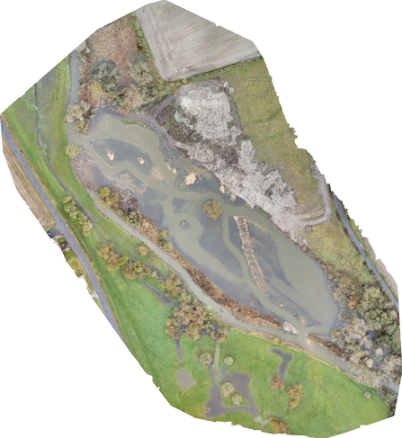
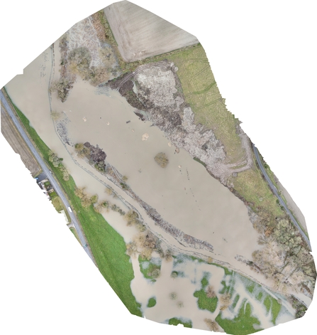
A floodplain is a flat area surrounding a river or stream, which floods when water levels rise.

For example, our Bay Meadows nature reserve flooded last week after the River Og which runs through the centre of the reserve burst its banks. Our volunteer reserve warden Paul took the below photo and told us this is the first time he’s seen the area flood in 20 years.

A flooded Bay Meadows nature reserve

Bay Meadows floodplain after heavy rain in Wiltshire.

Our Conigre Mead nature reserve also flooded, after water levels rose on the River Avon.

Conigre Mead flooded

Flooding at Conigre Mead nature reserve in Melksham, Wiltshire. Credit: Linda De Santiz.

Floodplains are a type of Natural Flood Management (NFM). This means working with nature to reduce the risk of flooding for communities by slowing or storing flood water – this is exactly what the floodplain at Bay Meadows did, protecting the new housing development nearby and preventing those properties from flooding, as well as those further downstream. It is important we protect floodplains like these, to allow them to protect our towns and cities following heavy rainfall.

We have been restoring floodplains across the county, including our Smallbrook Meadows nature reserve, where our Water Team have re-meandered the River Were to re-connect the river to its floodplain. We have increased the length of the river channel and allowed more water to be stored in-channel and in the wet margins.

Drone photo showing the changed course of the river

Drone photo of the River Were re-meandering work. Credit: BD Westby Contractors. This project is funded by National Highways Environment and Wellbeing Designated Fund as part of the Network for Nature programme.

We have also done a similar project which restored an area of wetland on the River Avon in West Chisenbury, putting the river back into the centre of the floodplain along a new channel.

The below images show the restored floodplain in action following a night of heavy rainfall, with just a day between each image being taken.

There are many benefits of Natural Flood Management, including enhancing habitats and biodiversity. Our floodplain meadows such as those at Clattinger Farm on our Lower Moor nature reserve are species-rich, and are some of only 200 floodplain meadows remaining in the country. Here, the wet soils support flower-rich swards, where rare plants such as the snakes-head fritillary can thrive.

Snakeshead Fritillaries

Snakeshead Fritillaries at Clattinger Farm in Wiltshire. Credit: Stephen Davis.

We have also created new wetlands at Lower Moor and Langford Lakes, which will store more water whilst also creating new habitats for wading birds.

Wetland scrapes at Lower Moor

The new wetland scrapes at Lower Moor nature reserve in Wiltshire.

With climate change increasing the severity of storms in the UK, more Natural Flood Management techniques such as restoring floodplains, re-meandering rivers and creating wetlands are going to be vital to prevent flooding across Wiltshire & Swindon in the future.